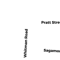
38 WHITMAN RD
Owner Information
HILLTOP GROUP HOLDINGS LLC
1 KELLY SQ
WORCESTER, MA 01610


Property Details
38 WHITMAN RD is classified as a Two-Family Residential (Two family).
The primary structure on this property was built in 1920. There are 7,513ft2 of built area within this property. There is 3,498ft2 of residential/living space within this property. This property is listed as having 12 rooms.
38 WHITMAN RD is valued at $408,500. The land is valued at $67,500 and the structures are valued at $327,300. There is an additional valuation of $13,700 on this property.
This property is in Zone RL-7. Confirm with local Zoning Board authorities to ensure there are no overlays or other easements on this property.
The most recent deed for 38 WHITMAN RD is recorded at the local registrar in Book 55684, Page 0345. 38 WHITMAN RD was last sold on Monday, July 25, 2016 for $100.
Assessment data from fiscal year 2021.
Flood Data
According to the FEMA National Flood Hazard Layer, this property does not appear to be in a flood zone. It may also be in an area not yet reviewed. Nonetheless, confirm this information prior to taking any action.
To view the flood hazards around this property, create a FEMA "Firmette" Map of the area around 38 WHITMAN RD.
Broadband Internet Providers
| Provider | Type | Bandwidth (mbps) | |
|---|---|---|---|
| Charter Communications Inc | Cable | 940 | 35 |
| CherryRoad Technologies Inc. | Fiber | 0 | 0 |
| Verizon New England Inc. | DSL | 7 | 0 |
| Viasat Inc | Satellite | 100 | 3 |
| GCI Communication Corp. | Satellite | 0 | 0 |
| VSAT Systems, LLC. | Satellite | 2 | 1 |
| HughesNet | Satellite | 25 | 3 |
| Crown Castle Fiber | Fiber | 0 | 0 |
Broadband service provider data from December 2020.
Adjacent Properties
- 74 SAGAMORE RD
Two-Family Residential owned by DOVETAIL PROPERTIES LLC - 76 SAGAMORE RD
Three-Family Residential owned by DOVETAIL PROPERTIES LLC - 36 WHITMAN RD
Single Family Residential owned by KURTZ,DVON R + HEATHER - 40 WHITMAN RD
Two-Family Residential owned by MITSIS CHRISTINA - 12 PRATT ST
Three-Family Residential owned by DICICCO REALTY LIMITED LIABILITY COMPANY